It was like a Google Earth project for eighteenth century Britain.
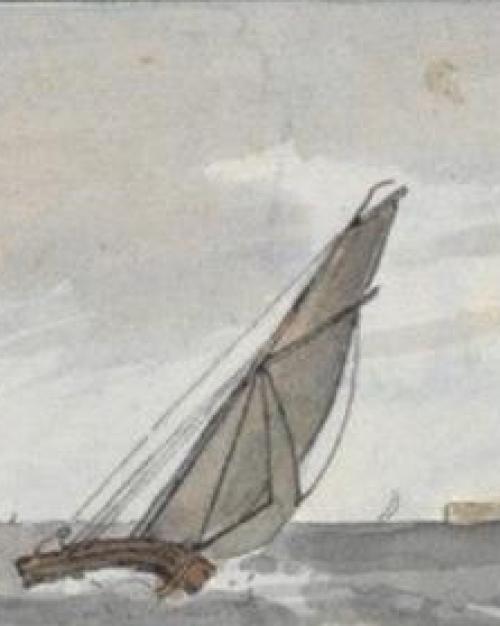
From 1799 to 1800, in the midst of the Revolutionary Wars, the British Admiralty sent artist John Thomas Serres sailing in warships along the coast of France to paint the landscape. The resulting sketchbook and 24 horizontal watercolor paintings were not meant to be decorative, wrote Kelly Presutti. Rather, the project was intended to give British captains a navigational edge against its enemies.

“In the midst of a war, at a time of crisis, the Admiralty turned to an artist,” said Presutti, assistant professor of history of art and visual studies. “I wanted to know what they thought he contributed, what they valued in art that science couldn’t supply. I’m always looking in my work for places where art reaches out beyond its perceived domain and intersects with other practices.”
In a paper published in the Massachusetts Institute of Technology’s Grey Room, Presutti details how art came together with military navigation to advance the British empire.
In the mid 1790s, the British Admiralty became aware that the arch-rival French outfitted its ships with excellent navigational charts showing nearly every “little harbour in Britain or Ireland,” Presutti wrote. Not to be outdone, the admiralty planned to do one better, commissioning a project to record accurate watercolor depictions of French coastline. The United Kingdom Hydrographic Office (UKHO) was founded in 1795 as a branch of the British Admiralty, commanders of the Royal Navy.
These watercolors fell into the art genre known as “views,” Presutti wrote: “Within Britain, the term applied to images ranging from detailed depictions of country houses (often one’s own country house and surrounding property) to landscape sketches made by traveling amateurs…views were associated with ownership.”
The British navy’s need for visual navigational tools recruited the humble view into a military project, Presutti wrote. Alexander Dalrymple, the first head of the UKHO, originally envisioned documenting the coastlines of the entire world. He wrote in 1781, “It is proposed to publish a complete collection or series of views of all the lands, from England to the most remote parts of the East-Indies; which will not only be very useful to Navigators, but comprehend such a description of the external form of the globe as cannot otherwise be had.”
But Dalrymple was also aware of the limitations of accurately rendering coastlines, Presutti wrote. When he became the head of the UKHO in 1795, he had to piece together workable navigational documents using scraps of coastline already depicted and train sailors to collect data for navigational charts.
Eighteenth century navigational charts and watercolor views, however, eventually helped the British build empire on the seas, Presutti wrote.
“That the UKHO could be an instrument of power, that it could steer Britain toward a triumphant empire and an enduring commonwealth, was not yet clear in the 1790s. By the end of the nineteenth century, however, the chart would become what historian and former Admiralty hydrographer M.K. Barritt terms ‘the unchallenged primary document’ in navigation; by the end of the twentieth, Britain would lead the world in hydrography.”
The British watercolor views of coastline are both art and navigational tool Presutti said: “These two things cannot be held apart if we are to understand them.”
The Yale Center for British Art holds some of the watercolors, treating the views as art. At the United Kingdom Hydrographic Office, in contrast, the views are often discussed in terms of degrees of accuracy, as ‘informational’ documents, Presutti said.
Presutti will teach a course on “Art and the Remapping of the World” in spring 2023 that expands on these themes.
“There is no such thing as an ‘objective’ map,” Presutti said. “Representation conditions the ways in which we navigate and ultimately encounter our world.”
Read the story in the Cornell Chronicle.
More News from A&S


Martie Young, ‘great hero’ of Johnson Museum of Art, dies at 96
History of Art and Visual Studies